- उर्वशी रौतेला 12.25 करोड़ रुपये में रोल्स-रॉयस कलिनन ब्लैक बैज खरीदने वाली पहली आउटसाइडर इंडियन एक्ट्रेस बन गई हैं।
- Urvashi Rautela becomes the first-ever outsider Indian actress to buy Rolls-Royce Cullinan Black Badge worth 12.25 crores!
- 'मेरे हसबैंड की बीवी' सिनेमाघरों में आ चुकी है, लोगों को पसंद आ रहा है ये लव सर्कल
- Mere Husband Ki Biwi Opens Up To Great Word Of Mouth Upon Release, Receives Rave Reviews From Audiences and Critics
- Jannat Zubair to Kriti Sanon: Actresses who are also entrepreneurs
Amrita Vishwa Vidyapeetham Signs MoU with Esri India to Set up Centre of Geospatial Excellence

The Centre would help develop specific skills and technical knowhow around geospatial technologies and latest toolkits like artificial intelligence, machine learning and Big Data Analytics
Delhi. Amrita Vishwa Vidyapeetham, ranked the 4th Best Overall University in India in NIRF 2020, has inked an MoU with Esri India, the market leader in Geospatial Information Systems, to establish a Centre of Geospatial Excellence on Spatial Analysis and Modeling with dedicated facilities for research, development and testing.
The Centre would promote development of specific skills and technical knowhow among academicians, students and the industry around geospatial technologies and latest toolkits like Artificial Intelligence (AI), Machine Learning (ML) and geospatial Big Data Analytics. It would conduct certificate and diploma courses, training programs and workshops, particularly around geospatial technology application areas to strengthen multi-hazard risk reduction and community resilience.
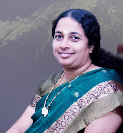
Talking about the MoU, Dr. Maneesha Sudheer, Dean of International Programs and UNESCO Chair on Sustainable Development and Innovation, Amrita Vishwa Vidyapeetham, said: “This partnership aims to enhance research and capacity development in Geoinformatics, Spatial Analytics, and Modelling.
The collaborative initiatives will work towards sustainable development to address quality education (SDG 4), gender equality (SDG 5), sustainable communities (SDG 11), and climate action (SDG 13) by engaging faculty, bachelors, masters, and Ph.D. students.
They will help enhance the existing curriculum and educational material, as well as develop new educational approaches for effective teaching and learning of sustainability initiatives using spatial geoinformatics.”
Added Agendra Kumar, President, Esri India: “Empowering the academic community with necessary tools and technologies needed for future-ready students and capacity building is one of our key priorities. Geospatial infrastructure is the core foundation of disaster-risk reduction, sustainability and resilience initiatives. Our collaboration with Amrita Vishwa Vidyapeetham will support various research initiatives and flagship programs such as Amrita Live-in-Labs for better sustainability and development.”
The MoU was inked during the International Symposium on Disaster Risk Reduction & Community Resilience that was jointly hosted by the Ministry of Earth Sciences, the Indian National Centre for Ocean Information Services (ESSO-INCOIS), Govt. of India, Esri India and Amrita Vishwa Vidyapeetham.
The event commemorated the 16th anniversary of the 2004 Indian Ocean Tsunami. The participants discussed the challenges faced and lessons learnt since that catastrophic event, and analysed India’s current preparedness in community resilience, governance and technological solutions to mitigate any future impact of tsunamis in India.
Dr. M. Rajeevan, Secretary, Secretary, Ministry of Earth Sciences; Chairman, ESSO-INCOIS; and Chairman, Earth Commission, Government of India, said: “Even though we have advanced tsunami-warning systems today, there are many grey areas where we need to improve. We have to engage scientists and technology experts to improve decision support systems and last-mile connection with people.”
Added Dr. T. Srinivasa Kumar, Director, Indian National Centre for Ocean Information Services (INCOIS), Ministry of Earth Sciences, Government of India: “With the state-of-the-art Tsunami Early Warning Centre at MoES-INCOIS, India is today much safer against the threat of tsunamis compared to 2004. However, challenges remain with respect to early warning and community response, especially for tsunamis triggered by non-seismic and near-source events. Strengthening SOPs of all constituent agencies and end-to-end tsunami early warning chains is also an important task.”

Dr. Maneesha Sudheer, Dean of International Programs and UNESCO Chair on Sustainable Development and Innovation, Amrita Vishwa Vidyapeetham, said, “The symposium served as a platform to integrate the last 16 years of advancements in science and technology to improve the rehabilitation and resilience of coastal communities. It stressed on scientific social responsibility to reduce risk and vulnerability factors by understanding the impact of tsunamis on coastal communities, using latest advances in monitoring and modeling of tsunamis, and coming up with a strategic framework to further advance India’s disaster preparedness and build sustainable and resilient communities.”


